http://geog411.blogspot.com
Link for geography 411
Thursday, January 31, 2008
Friday, January 25, 2008
Political map of Australia
Tuesday, December 11, 2007
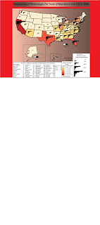
My final project

Site I got my data from
http://www.fbi.gov/ucr/cius2006/data/table_69.html
Sites that relate to my data
This chloropleth map shows homicide density in Washington D.C. from 1994-1995
http://www.ojp.usdoj.gov/nij/maps/images/bb2.gif
This chloropleth map shows homicide locations in D.C. from 1994-1995
http://www.ojp.usdoj.gov/nij/maps/images/bb1.gif
It's not a descriptive map, but this is supposed to show murders occurring in Papua New Guinea
http://www.papuaweb.org/goi/pp/peta-hr.gif
This is another map that isn't descriptive, but it shows homicide locations in Boston, Mass.
http://www.bpdnews.com/bpd_map_122105.gif
This is a map of the worst homicide locations in Baltimore, Maryland.
http://www.examiner.com/images/newsroom/Image/murder_map.jpg
Saturday, December 8, 2007
Thursday, December 6, 2007
Check this map out
 http://www.alcoholpolicy.niaaa.nih.gov/
Minimum Age To Sell Beer for Off-Premises Consumption as of January 1, 2007 . So this is a map for where you can sell beer and at what age.
I thought this was a nice map
Subscribe to:
Posts (Atom)


